
A winter storm is on its way to Central Illinois, and residents need to prepare for the challenging weather conditions that could impact travel this week. As a cold front moves in, the region will experience a mix of freezing rain, rain, and snow, with varying degrees of severity throughout the week. Let’s break down the forecast and what you can expect over the next five days.
Tuesday and Wednesday: Freezing Rain and Icy Roads
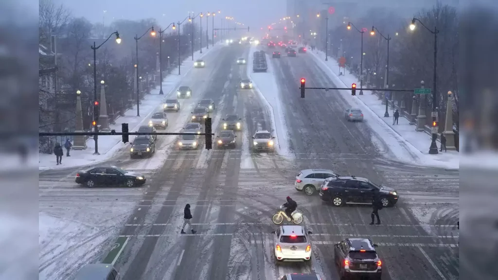
The weather pattern will start to shift late Tuesday, with rain beginning to fall in the region. As temperatures drop overnight, that rain will turn into freezing rain by early Wednesday morning, making for dangerous driving conditions, especially along the I-70 corridor. The National Weather Service is urging drivers to be cautious, as icy roads can make travel treacherous.
The freezing rain is expected to develop early Wednesday morning, continuing through midday, before transitioning to regular rain by Wednesday afternoon. However, during the morning hours, the roads will remain icy, and there will be a potential for ice accumulation, which could further complicate driving.
Winds will also pick up during the storm, with gusts reaching up to 17 mph. This will not only reduce visibility but could also lead to hazardous conditions on the road. If you are planning to travel on Wednesday morning, it is advised to allow extra time and check road conditions before heading out.

Thursday: A Brief Break with Partly Sunny Skies
As the storm moves out, Thursday will bring a brief break in the weather. Expect partly sunny skies throughout the day, and temperatures will rise to a more moderate 46°F. While this will offer a much-needed respite, residents should keep an eye on the forecast, as another round of wet weather is just around the corner.
Friday Night into Saturday: More Precipitation and Possible Snow
The brief reprieve will come to an end as another storm system begins to approach Central Illinois on Friday night. As the system moves through, it will bring a new round of precipitation. While this storm is expected to bring mostly rain, there is also a chance for snow, particularly in the later hours of Saturday.
Though the details are still being fine-tuned, it’s expected that this second storm will bring another round of wet conditions, making the ground even wetter and more difficult to manage, especially for those on the road. Travel could be impacted, especially in areas further north, where the precipitation may transition to snow or sleet.
The National Weather Service will continue to monitor this system closely and will issue any necessary warnings as the storm develops. It’s recommended to stay tuned to local weather updates as we get closer to the weekend.

5-Day Forecast Overview:
Here’s a quick summary of what you can expect over the next five days in Central Illinois:
- Tuesday (February 4): Rain will begin late in the day, transitioning to freezing rain overnight into Wednesday. Travel conditions will deteriorate, with icy roads and the potential for ice accumulation.
- Wednesday (February 5): Freezing rain continues in the morning, turning to regular rain by the afternoon. Temperatures will rise above freezing by midday. Winds up to 17 mph could reduce visibility.
- Thursday (February 6): A brief break with partly sunny skies. Highs will reach 46°F. It will be a mild day, but prepare for the next storm system arriving soon.
- Friday (February 7): Another storm system arrives overnight, bringing more rain and a chance of snow. Snow is more likely later in the weekend, with precipitation continuing into Saturday.
- Saturday (February 8): Snow may fall, depending on the storm’s path, bringing the possibility of hazardous travel conditions. Stay tuned for updated forecasts.
Preparing for the Storm:
Given the forecasted conditions, it’s important to be proactive in your preparations for the upcoming winter weather. Here are a few tips to help you stay safe and ready for the changing conditions:
- Travel Precautions: If you have to travel on Wednesday morning, allow for extra time. Plan ahead by checking the road conditions before heading out, and consider postponing non-essential travel until conditions improve. Avoid driving on icy roads whenever possible.
- Keep Your Car Prepared: Before the storm hits, make sure your car is equipped for winter driving. Check your tire pressure and ensure you have enough windshield washer fluid. It’s also a good idea to keep an emergency kit in your car, including a blanket, snacks, and a flashlight.
- Home Safety: If the storm causes power outages, it’s a good idea to have emergency supplies on hand. This includes extra blankets, batteries, flashlights, and non-perishable food. Be sure to keep your phone charged, and consider investing in a backup power source, like a portable charger or a generator.
- Monitor Local Weather: Keep an eye on local weather reports for updates, especially as the second storm system approaches on Friday. The weather can change quickly, so it’s important to stay informed.
Conclusion
This week’s weather in Central Illinois will bring several challenges, including freezing rain, ice, and snow, which could create hazardous travel conditions. By preparing in advance and staying informed about weather updates, you can minimize the impact of the storm on your safety and daily plans.
The storm system moving in late Tuesday will bring icy roads and potentially dangerous conditions on Wednesday. Thursday will provide a brief reprieve, but by Friday night, another round of wet weather could bring more rain and snow. Be sure to monitor local weather reports and take necessary precautions to stay safe.

Disclaimer – Our editorial team has thoroughly fact-checked this article to ensure its accuracy and eliminate any potential misinformation. We are dedicated to upholding the highest standards of integrity in our content.
More Stories
Icy Roads and Snow Expected in Central Illinois
Icy Roads and Snow Expected in Central Illinois
Icy Roads and Snow Expected in Central Illinois