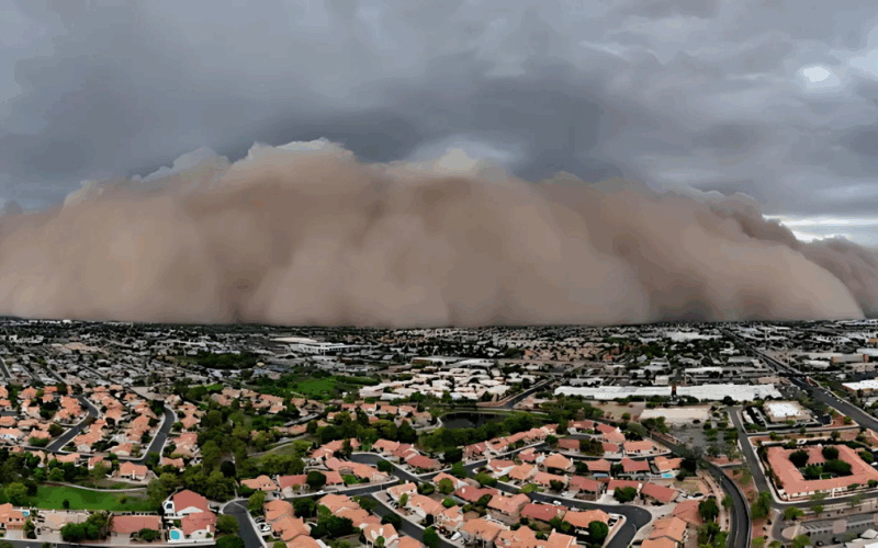
Arizona – Residents across Arizona should prepare for an increase in monsoon thunderstorms and severe weather conditions over the next several days, from September 3 to 6, 2025, as tropical moisture pushed by Hurricane Lorena impacts the state. Though Arizona will not face a direct hit from the storm, the influx of moisture will intensify the already active monsoon pattern, sparking possible thunderstorms, strong winds, hail, and localized flooding.
Currently designated as Tropical Storm Lorena, the system is predicted to strengthen into a hurricane by Wednesday, making landfall in the Central Baja Mexico area on Friday as a tropical storm before weakening into a tropical depression over northern Mexico. Despite the storm’s path remaining outside of Arizona, the state will experience significant weather changes due to the enhanced tropical moisture and atmospheric instability.

Monsoon Activity Set to Intensify Midweek
According to The Arizona Weatherman, a veteran meteorologist with over 25 years of experience, monsoon activity will surge starting Wednesday afternoon, especially across western to central Pima County and northern counties including Coconino, Yavapai, and Mohave along the Mogollon Rim. This increase is fueled by strong upper-level diffluence, unstable air, and abundant tropical moisture.
- Instability indices include a CAPE around 3,000 and Lifted Indices (LI) near -7, indicating a highly unstable atmosphere.
- Positive hail indicators raise concerns about one-inch hail occurrences.
- Wind gusts over 60 mph and potential for localized flooding and dust storms are expected.
“I expect the potential for severe weather including strong winds, hail, and localized flooding affecting residents in the affected counties,” said The Arizona Weatherman.

Thunderstorm Risks Expand Thursday and Beyond
As the week progresses, thunderstorms will continue to develop, extending into Pinal County by Thursday with increased chances for Tucson. The severities remain elevated with continued risk of strong winds, hail, and flash flooding.
- Mogollon Rim and Pima County expected to see persistent thunderstorm activity.
- Weather threats include sustained winds >60 mph and localized flooding.
- Continued elevated instability maintaining severe weather potential.
Weekend Weather Impact from Hurricane Lorena’s Remnants
By Friday and Saturday, the remnants of Hurricane Lorena moving through the Gulf of California and northern Mexico will further enhance moisture flow into southern Arizona. Counties such as Pima, Santa Cruz, and Cochise should prepare for increased rainfall and thunderstorm activity, with localized flooding a significant concern.

- Forecasted rainfall amounts: 1-3 inches, with potential for heavier accumulations from stronger storms.
- Higher risk of flash flooding in low-lying and urban areas.
The Arizona Weatherman’s trusted forecast, supported by decades of meteorological experience including his background with the United States Air Force and expertise training Special Operations Weather Technicians, underscores the importance of vigilance during this active weather period. More details and updates can be found here.
Preparing for the Days Ahead
- Stay informed with local weather updates for potential flash flood warnings.
- Secure outdoor items to protect against strong winds and hail damage.
- Avoid driving through flooded roads and watch for dust storm conditions.